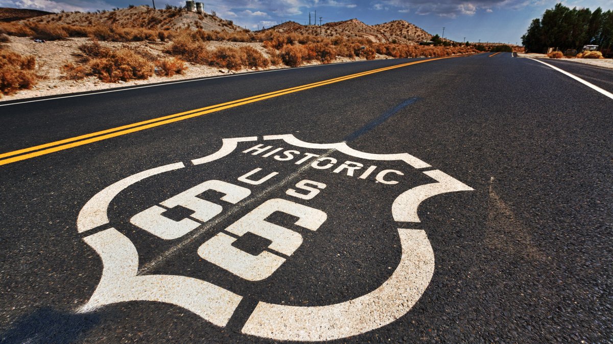
Route 66 is turning 100, and the road John Steinbeck nicknamed the "Mother Road" is no longer the simple drive it was when it carried travelers between the Midwest and California. The Interstate system pulled its traffic away decades ago, and long stretches have since been abandoned, taking with them the gas stations, diners, and roadside curiosities that once made the journey worthwhile. For anyone tempted by a centennial road trip, the obstacle is no longer ambition — it is knowing what still exists out there. One dedicated fan has now answered that question in unusual detail, mapping the entire surviving route into a single scrollable app.
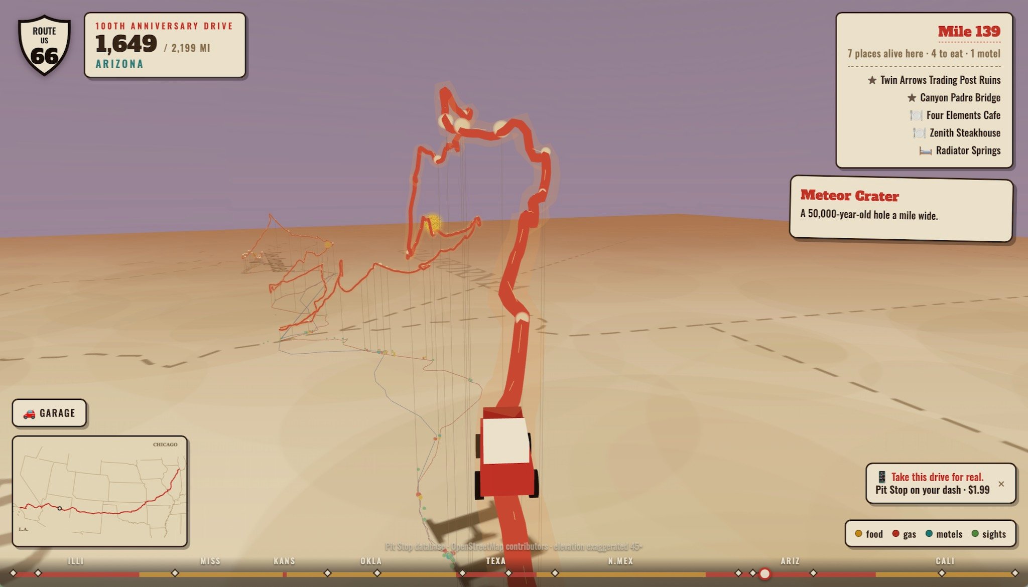
Jake Boyles, the developer behind Pit Stop: Road Trip Exit Guide, spent the past summer charting the historic highway from one end to the other. The result is a Route 66 edition of his app, and it allows users to travel all 2,199 miles without ever leaving the couch, following elevation changes mile by mile while seeing the places worth stopping along the way.
How a Highway Exit App Became a Route 66 Atlas
The original Pit Stop app serves a straightforward purpose: it surfaces restaurants and other points of interest located near highway exits, the kind of information that matters when you are deciding where to pull off for the night or for a meal. Boyles applied that same practical logic to a road that no longer functions as a main artery between regions. Instead of interstate exits, the Route 66 version plots towns, landmarks, and services across the full length of the corridor, giving the highway a digital layer it never had when it was the primary way west.
2,199 Miles, From Chicago to the Pacific
The mapped route begins in downtown Chicago, just a few blocks from the shore of Lake Michigan, and ends at the Santa Monica Pier — as far west as a driver can go without steering into the Pacific Ocean. In between lies the sprawl of small towns, open plains, desert, and mountain country that gave the highway its reputation. Because the road is mostly out of the way now, those miles are rarely interrupted by the kind of modern highway travel center that makes long-distance driving easy elsewhere.
Pick a Car, Then Head West
The app offers a small touch of nostalgia before the trip begins. Users can choose a car to travel in, including one rendered in an appropriately 1950s shade of turquoise, or a white roadster that evokes the Corvettes featured in the 1960s Route 66 television series. It is a cosmetic detail, but it fits the spirit of a highway that has always been as much about atmosphere as about transportation.
Elevation Along the Way
Elevation changes are displayed as you progress, which matters more than it might sound. Route 66 was never a flat ribbon; it climbed through the Ozarks, crossed high desert plateaus, and descended toward the coast. Seeing that profile laid out alongside the stops gives a clearer sense of what a real drive would demand than a simple line on a map ever could.

The Logistics of Driving a Road That No Longer Serves Through Traffic
Practical information is where the project earns its keep. In a Reddit post, Boyles said he mapped roughly 2,400 places to eat and 1,300 motels spread across the 280 towns along the route. That kind of inventory is essential on any long trip, but it is especially critical here, because the mostly out-of-the-way highway means drivers are far less likely to stumble onto a modern travel center or a cluster of development on the more rural stretches.
- Restaurants and food stops: about 2,400 mapped along the corridor
- Motels and lodging: approximately 1,300 entries
- Fuel stations: included among the essentials for the trip
- Towns covered: 280 communities strung along the route
For anyone planning the drive in person, that data turns a vague historical pilgrimage into something closer to an itinerary. For everyone else, it is a way to wander the highway at will, zooming from one small town to the next.
Landmarks Worth the Detour
The road's remaining attractions are part of what keeps it culturally alive, and the app carries them too. Two examples stand out for very different reasons.
A Corner in Winslow, Arizona
Travelers who appreciate the Eagles — the band, not the football team — can route themselves through Winslow, Arizona, and stand on a corner there, a nod to the town's place in the song "Take It Easy." It is the kind of small, specific stop that defines Route 66 travel: unremarkable on a map, memorable in person.
Meteor Crater and the Apollo Connection
A few miles down the road from Winslow sits Meteor Crater, where NASA astronauts once trained in preparation for the Apollo missions. That combination — a pop-culture corner and a geological landmark tied to the space program — captures how broadly the highway's story ranges.

How Route 66 Lost Its Traffic
Route 66 was established on November 11, 1926, as part of the original U.S. highway system, and it loomed large in American life almost immediately. Steinbeck called it the "Mother Road" in The Grapes of Wrath, cementing its place in the national imagination, and it became the defining symbol of road trip culture — kooky roadside attractions included.
Interstate Bypass and the 1985 Delisting
Most of its traffic was diverted to the Eisenhower-era Interstates during the 1950s and 1960s, and the highway was removed from the federal system entirely in 1985. Today some sections resemble off-road trail more than paved highway. That decline is exactly what makes a complete, current map valuable: the road persists, but it no longer announces itself.
Why the Map Matters
Route 66's centennial arrives at an awkward moment for the highway itself. The communities along it have spent years trying to preserve what remains, and interest in the route has never fully faded. A resource that documents all 2,199 surviving miles — where to eat, where to sleep, what rises and falls along the way — lowers the barrier for the people most likely to keep those towns alive: the ones who actually show up.
It also serves a quieter purpose. For readers who will never drive the route, scrolling through it offers a sense of the scale and texture of the highway, town by town, without a tank of gas or a week of vacation. The road that once promised the West to anyone with a car now fits on a phone screen. That is not the same as being there. But it is a much better map than most of what came before.
This article is based on reporting by The Drive. Read the original article.

Originally published on thedrive.com



![Kia launches three new GT EVs, including an electric hot hatch and two SUVs [Images]](https://electrek.co/wp-content/uploads/sites/3/2026/09/Kia-EV3-GT-EV4-GT-EV5-GT.jpeg?quality=82&strip=all&resize=1200,628)