Satellites Turn Penguin Colonies Into a Climate Signal
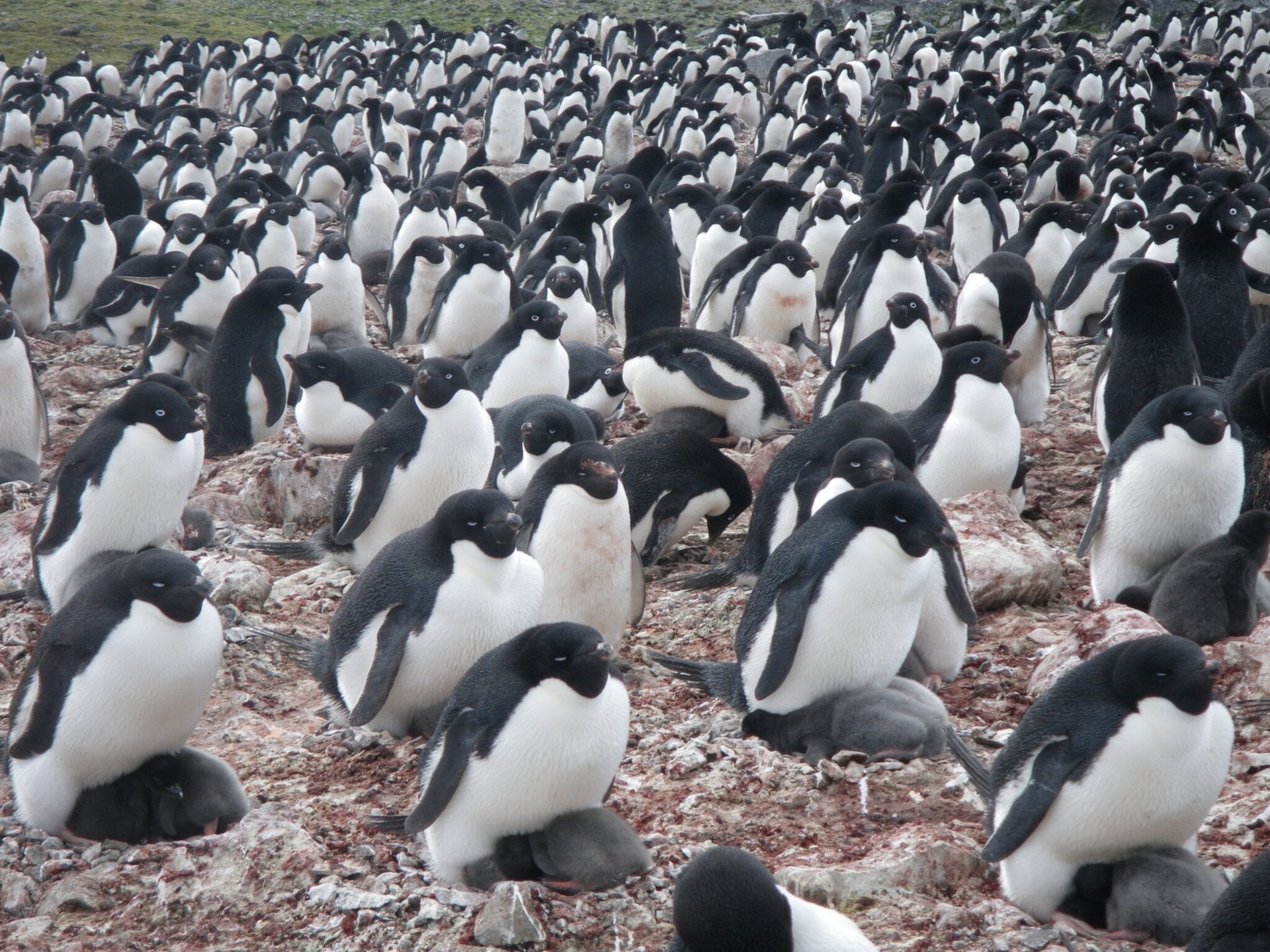
Researchers have used three decades of Landsat satellite imagery to reconstruct changes in the diet of Ade9lie penguins across Antarctica, opening an unusual new window into how climate change is reshaping one of Earth92s most extreme ecosystems. The work, reported in a study in Current Biology, relied on a source that is as unglamorous as it is revealing: penguin guano.
By analyzing the color and spectral properties of guano deposits visible from space, the team built a continental-scale record of what Ade9lie penguins were eating from 1984 to 2013. That matters because the species99 diet changes with local sea-ice conditions. In areas with more sea ice, Ade9lie penguins typically eat more fish. Where sea ice declines, they tend to consume more krill. Tracking those shifts gives scientists a way to measure broader changes in Antarctic food webs over time.
The study is notable not just for its conclusions, but for its method. Antarctica is vast, remote, and difficult to study in a coordinated way over decades. Traditional fieldwork can produce detailed local snapshots, but scaling that work across the continent is expensive and logistically difficult. Satellite observations, by contrast, can repeatedly cover enormous areas and preserve a historical record that researchers can revisit as analytical techniques improve.
How Guano Became a Dietary Archive
The research team, led by Clemson University with collaborators from Stony Brook University, UC Santa Cruz, NASA, and other institutions, used visible and infrared Landsat data to identify the spectral signature of Ade9lie penguin guano. They then paired those satellite observations with guano samples collected from colonies and analyzed in the lab.
Those lab measurements helped the team understand how guano color relates to diet. The researchers also ran stable isotope analysis on the samples to determine whether the penguins had eaten relatively more fish or more krill. With that combined dataset, they built a model linking guano spectra to dietary composition and then applied that model to the Landsat archive.
The result was a long-term map of penguin feeding patterns across Antarctica. According to the source report, this is the first time satellite observations have been used to measure food-web dynamics on a continental scale over a span of decades. That distinction matters because food webs are often inferred indirectly or reconstructed from limited regional field campaigns. Here, the researchers were able to connect a biological signal visible from orbit to ecosystem change over time.
Why Ade9lie Diet Shifts Matter
Ade9lie penguins are closely tied to sea-ice conditions, making them a useful indicator species for climate-driven change in Antarctica. The source text describes rising temperatures, increasing ocean acidity, and shrinking sea ice as existential pressures for many species in the region. For Ade9lie penguins, the loss of sea ice does not just alter habitat. It also appears to reshape access to prey.
That dietary shift has consequences. Fish- and krill-based diets do not signal the same ecological conditions, and a transition from one to the other can reflect substantial changes in local marine systems. By showing where and when those transitions occurred, the researchers created a measurable link between climate change and penguin feeding ecology.
The study99s conclusions are described in the source as alarming. The team found evidence that warming conditions and shrinking sea ice are altering penguin diets in ways that could affect health and longevity. In other words, the change is not limited to what penguins are eating. It may also point to downstream biological stress for the species.
That kind of signal is especially valuable because Antarctic ecosystems are hard to observe continuously. A method that can infer diet from satellite imagery offers a way to monitor ecological response over very large areas without sending field teams to every colony. It also makes it possible to compare conditions across multiple decades using the same observation platform.
A New Tool for Earth System Science
Beyond the penguins themselves, the work suggests a broader shift in what satellite Earth observation can do. Landsat has long been used to monitor land cover, glaciers, vegetation, coastlines, and other physical changes. This study pushes that capability further into ecology by showing that orbital data can help track food-web dynamics and population-related biological patterns.
That expansion is significant because climate change often unfolds through linked systems rather than single variables. Sea ice changes affect prey availability. Prey availability affects predator diet. Diet shifts may affect health, reproduction, and long-term population stability. If satellites can help measure several parts of that chain, they become more useful not only for mapping environmental change, but for understanding biological consequences.
The researchers also benefited from the longevity of the Landsat program. A 30-year record is long enough to reveal persistent trends rather than short-lived anomalies. In places like Antarctica, where seasonal and annual variability can be substantial, long timelines are essential for separating structural climate effects from temporary fluctuations.
The study does not claim to solve every uncertainty in Antarctic ecology. But it does provide a scalable technique for linking remote sensing to diet and ecosystem change. That could make it easier to monitor other hard-to-access environments where direct biological sampling is sparse or costly.

What the Findings Suggest
The central message is straightforward: climate change is leaving a detectable mark not only on Antarctic ice and temperature patterns, but also on the feeding behavior of a species deeply embedded in the region99s marine food web. By turning guano color into a long-term ecological dataset, the researchers found a way to make those changes visible at continental scale.
For policymakers and conservation researchers, that matters because it converts a broad climate concern into a measurable biological response. For remote sensing science, it shows that archival satellite imagery can support more sophisticated ecological analysis than many observers might expect. And for Antarctica, it adds another line of evidence that warming conditions are altering systems once thought too remote to track in detail.
The novelty of the approach is likely to draw attention on its own. But the bigger significance lies in what it reveals: as sea ice declines, the effects ripple outward through prey, predators, and ecosystem structure. In this case, those ripples were recorded over decades and observed from space, using one of the most unexpected indicators in climate science.
This article is based on reporting by Universe Today. Read the original article.
Originally published on universetoday.com