
Satellite View Captures A Familiar Dry-Season Hazard
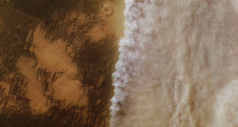
A NASA Earth Observatory image from April 22, 2026, shows smoke spreading across northern Thailand, partially obscuring the valleys and mountain ridges around Chiang Mai. The view was captured by the Moderate Resolution Imaging Spectroradiometer, or MODIS, aboard NASA’s Terra satellite.
Chiang Mai, Thailand’s second-largest city, sits among narrow valleys in the northern highlands. The same geography that gives the region its scenic mountain setting can also worsen air pollution. NASA noted that surrounding mountains can restrict airflow and promote temperature inversions, trapping smoke and other pollutants in valley communities.
Fires Intensified Through The Dry Season
The smoke is consistent with northern Thailand’s seasonal fire pattern. According to NASA, satellite sensors detected small numbers of fires in January 2026, followed by more numerous and widespread detections in February, March, and April. Fire activity in the region typically peaks in March and fades by May as seasonal rains increase.
Most of the smoke likely comes from small agricultural and forest fires. Such fires may be set to burn crop debris or maintain forest ecosystems. NASA’s account also identifies vehicles, power plants and industry, and charcoal burning for cooking and heating as smaller contributors to regional haze.
Air Quality Reached Unhealthy Levels
On the same day Terra observed the haze, ground-based air quality sensors recorded “unhealthy” and “very unhealthy” levels of fine particulate matter, known as PM2.5, across Chiang Mai and the surrounding region, according to data cited by NASA from the World Air Quality Index project.
Research referenced by NASA indicates that smoke from biomass burning is one of the largest contributors to poor dry-season air quality in northern Thailand. One estimate cited in the agency’s report attributes about 70 percent of Chiang Mai’s April PM2.5 to biomass burning.
The satellite image underscores how regional fire activity, local emissions, and valley terrain can combine into a persistent seasonal pollution problem. For Chiang Mai, the issue is not just atmospheric visibility; it is a recurring public-health and environmental challenge that becomes most visible during the late dry season.
This article is based on reporting by science.nasa.gov. Read the original article.
Originally published on science.nasa.gov


](https://www.universetoday.com/article_images/noirlab2510a_dp.jpg_20260720_214642.webp)