Three Decades of Ice Retreat
Antarctica has lost nearly 5,000 square miles of grounded ice over the past 30 years, according to a comprehensive satellite analysis that reveals the accelerating impact of warming ocean waters on the continent's most vulnerable glacial regions. The area lost is roughly equivalent to the size of Connecticut, representing a significant and ongoing transformation of the Antarctic ice sheet.
Grounded ice refers to portions of the ice sheet that rest on bedrock below sea level, as opposed to floating ice shelves that extend over the ocean surface. The distinction is critical because grounded ice loss directly contributes to sea level rise — when ice that was previously supported by land flows into the ocean and melts, it adds new water to the global ocean system.
What the Satellite Data Shows
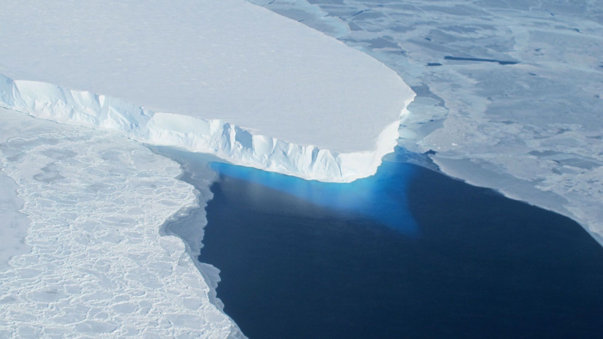
The study combined three decades of satellite observations to track changes in the boundary between grounded and floating ice across the entire Antarctic coastline. This boundary, known as the grounding line, is one of the most important indicators of ice sheet health because its retreat signals that warm ocean water is reaching and melting the underside of the ice where it contacts bedrock.
Researchers found that grounding line retreat is concentrated in specific regions that are exposed to warm ocean currents, particularly in West Antarctica and parts of the Antarctic Peninsula. These areas have experienced the most dramatic changes, with some glaciers retreating by tens of kilometers over the study period.
The Thwaites Glacier, sometimes called the Doomsday Glacier due to its potential to drive significant sea level rise, is among the most affected. Its grounding line has retreated substantially, exposing more of the glacier's underside to warm water and accelerating the rate of ice loss. The Pine Island Glacier, another major contributor to Antarctic ice loss, shows similar patterns of retreat.
The Role of Warm Ocean Water
The primary driver of grounded ice loss in Antarctica is not surface melting from warmer air temperatures, as is the case in much of the Arctic, but rather the intrusion of warm ocean water beneath the ice sheet. Changes in ocean circulation patterns, driven in part by shifting wind systems associated with climate change, are directing warmer water toward the Antarctic coastline and underneath floating ice shelves.
When this warm water reaches the grounding line where ice meets bedrock, it melts the ice from below, causing the grounding line to retreat inland. As the grounding line moves deeper into the continent, it exposes thicker sections of ice to the ocean, potentially creating a self-reinforcing feedback loop in which retreat accelerates over time.
This marine ice sheet instability mechanism is one of the most concerning aspects of Antarctic ice loss because it suggests that certain thresholds, once crossed, could lead to irreversible retreat of large sections of the ice sheet over decades to centuries.
Sea Level Implications
The West Antarctic Ice Sheet alone contains enough ice to raise global sea levels by approximately 3.3 meters, or about 11 feet, if it were to melt entirely. While complete melting would take centuries to millennia under current conditions, the satellite data shows that the process of destabilization is already well underway in the most vulnerable regions.
Current estimates suggest that Antarctic ice loss is contributing approximately 0.3 millimeters per year to global sea level rise, a figure that has been increasing over time. Combined with ice loss from Greenland and thermal expansion of warming ocean waters, total sea level rise is now occurring at a rate of approximately 3.7 millimeters per year, more than double the rate observed in the early 1990s.
Even modest sea level rise has disproportionate impacts on coastal communities, increasing the frequency and severity of flooding events, accelerating coastal erosion, and threatening freshwater supplies through saltwater intrusion. Island nations and low-lying coastal regions are particularly vulnerable to these effects.

Looking Ahead
The satellite record provides a critical baseline for understanding how the Antarctic ice sheet will respond to continued warming in the decades ahead. Climate models project that ocean warming around Antarctica will continue and likely intensify, suggesting that the rate of grounded ice loss will accelerate.
International scientific programs are working to improve monitoring of Antarctic ice dynamics, with new satellite missions and autonomous ocean-going instruments providing increasingly detailed observations of the processes driving ice loss. This data is essential for refining sea level projections and informing adaptation planning for coastal communities around the world that will be affected by rising seas.
This article is based on reporting by Space.com. Read the original article.
Originally published on space.com