Laser mapping exposes a much larger archaeological landscape in the Amazon
A new lidar survey of the Amazon rainforest has revealed 396 previously unknown geoglyphs in Brazil, dramatically expanding the known footprint of an ancient society called the Aquiry. The findings, reported in a study published July 29 in Nature and described by Live Science, add to growing evidence that parts of the Amazon were shaped by large, organized human populations long before European contact.
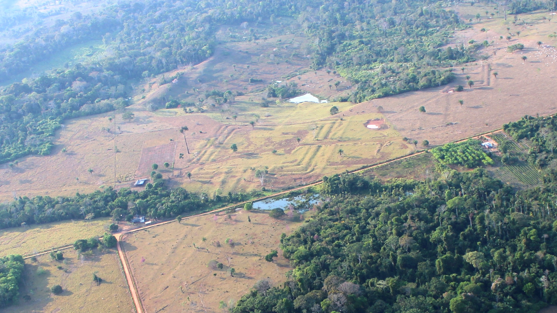
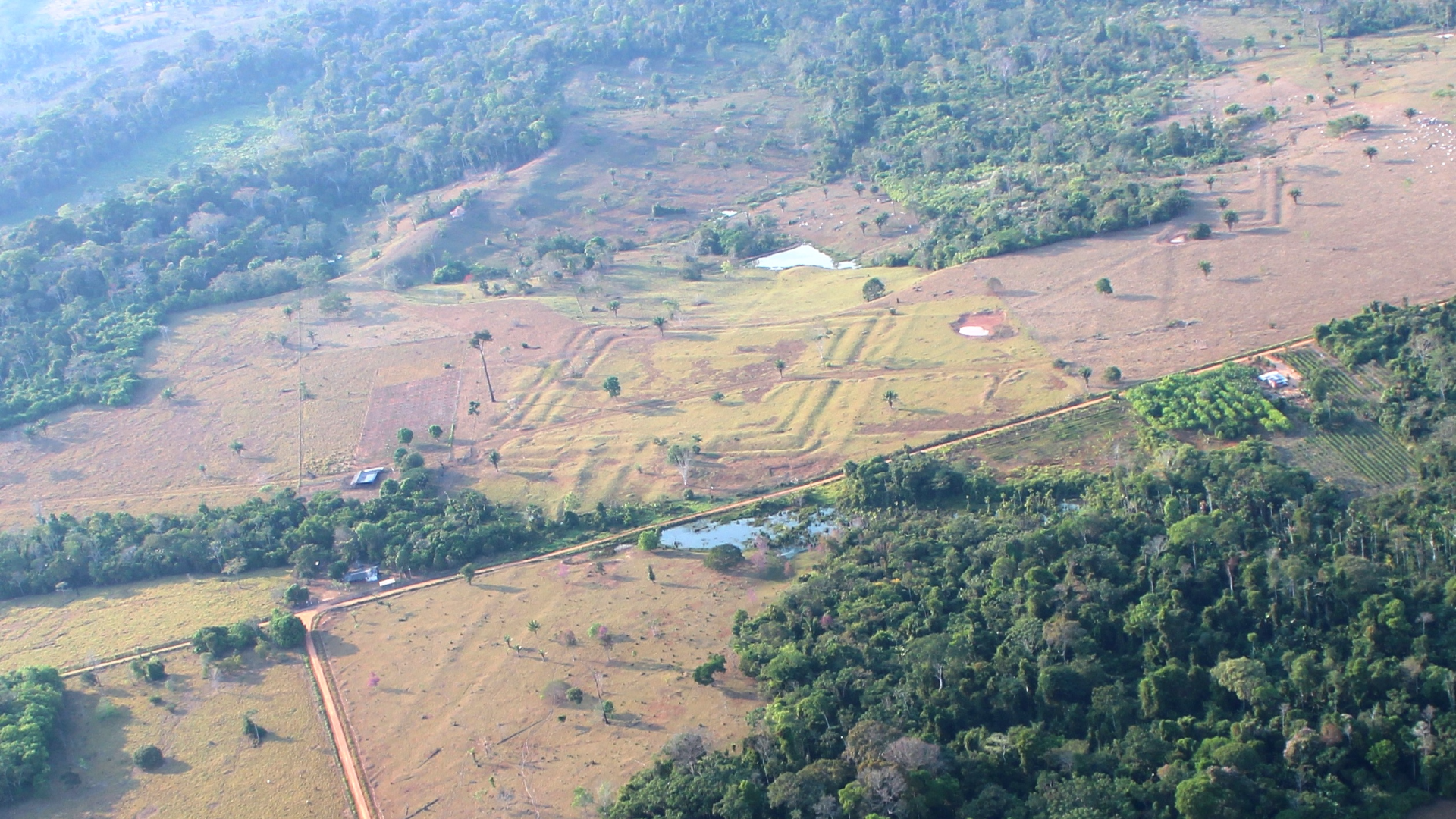
The work focused on nearly 1,740 square miles, or 4,500 square kilometers, of rainforest. By using laser scanning technology that can detect ground features beneath dense tree cover, researchers were able to identify monumental earthworks that would be difficult or impossible to map from the ground alone. The newly documented structures include geometric ceremonial centers marked by deep ditches and raised embankments, a form commonly described as Amazonian geoglyphs.
The scale matters as much as the count. According to the study summary cited by Live Science, the survey allowed archaeologists to better estimate the geographic extent of the Aquiry civilization, a multicultural society that researchers say arose about 2,500 years ago in what is now Brazil. Based on the number of known earthworks, the researchers suggested the society may once have had a population of around 3 million people before it later collapsed.
A hidden civilization comes further into view
The Aquiry name is not new, but this study strengthens the case that it describes a broad and complex cultural landscape rather than a scattering of isolated sites. Archaeologist Martti Pärssinen of the University of Helsinki, who has studied geometric earthworks in Acre state for more than two decades, told Live Science that the cultures and societies making up the Aquiry shared a common worldview and built ceremonial centers in a range of monumental geometric forms.
That point is important because the Amazon has often been framed in older narratives as an environment that could not support large, enduring societies at scale. Over the past several years, archaeology has steadily undermined that assumption. The new lidar results push the discussion further by showing that monumental construction was not marginal or rare in this part of the basin. Instead, it appears to have been widespread enough to define a major regional civilization.
The newly found geoglyphs also suggest that much of the archaeological record may still be hidden under forest canopy. Traditional survey methods are slow in this terrain and limited by vegetation, but lidar can penetrate gaps in the canopy and create detailed surface models. That makes it a particularly powerful tool for regions where earthworks are large yet visually obscured from above.
In practical terms, the study does not just add new dots to a map. It changes the baseline for how much of the ancient built environment may still be undocumented. If nearly 400 additional sites can emerge from one survey area, it raises the possibility that the broader Amazon still contains extensive archaeological landscapes that have yet to be recorded systematically.

Why the geometry of these sites matters
The earthworks identified in Acre are not random disturbances. They are monumental geometric constructions, often with clear formal layouts that indicate planning, labor coordination, and repeated cultural practices. Deep ditches and high embankments imply substantial effort, while the recurring shapes point to shared ideas about ceremony, place, and social order.
Researchers cited in the Live Science report interpret these centers as evidence of a common worldview across the Aquiry cultural sphere. That does not mean the population was politically uniform, but it does suggest strong links in ritual or symbolic life. In archaeology, repeated monument forms across a wide area can signal communication networks, shared traditions, or regional institutions that helped coordinate communities over time.
The findings also carry weight in debates over how ancient Amazonian societies organized themselves. Monument building on this scale requires more than a small village workforce. Even without claiming a single centralized state, the construction of hundreds of geoglyphs points to sustained collective action and social structures capable of planning, maintaining, and transmitting these practices across generations.
Because the Aquiry is described as multicultural, the emerging picture is not one of a monolithic civilization but of interconnected societies participating in a broader cultural system. That nuance matters. It suggests the Amazon may have supported different social formations that were locally distinct yet tied together through shared ceremonial architecture and landscape use.
A technological shift for Amazon archaeology
The study is also a marker of how remote sensing is changing field archaeology. In heavily forested regions, lidar is increasingly becoming a first-pass discovery tool that can guide excavation, dating, and ground verification. Rather than replacing traditional archaeology, it helps researchers prioritize where to look and how to understand the scale of what they are finding.
For Amazon research, that shift is especially significant. Dense vegetation has long obscured settlement patterns, roads, and earthworks, making it easier for older interpretations to underestimate past population density and landscape modification. Lidar offers a way to test those assumptions systematically.
The new survey results fit a broader pattern in which technology is revising the human history of tropical forests. Instead of viewing rainforest as a near-pristine backdrop only lightly touched by earlier populations, archaeologists are increasingly documenting engineered landscapes, managed ecosystems, and large ceremonial complexes. The Acre geoglyphs add another major dataset to that reevaluation.
They may also affect conservation thinking. Archaeological sites hidden within rainforest are part of the region’s heritage, but they can be vulnerable to deforestation, land conversion, and infrastructure development before they are even identified. Better mapping can therefore serve not only research goals but also preservation.

What this discovery changes
The strongest immediate takeaway is simple: the ancient human footprint in this part of the Amazon was larger and more organized than previously mapped. A survey of one region uncovered hundreds of additional geoglyphs and helped define the reach of a civilization that researchers say flourished roughly 2,500 years ago.
That does not settle every question. The population estimate cited in the report, the relationships among different Aquiry communities, and the reasons for the civilization’s collapse will all require further investigation. But the study materially advances the conversation by showing that the built landscape was both extensive and deliberately monumental.
For a field that has been steadily revising assumptions about Amazonian history, the result is another clear signal that the forest still holds large-scale evidence of past societies. The Aquiry were not leaving behind faint traces. They were reshaping the land in ways that can still be measured two millennia later, even if modern observers needed laser mapping to see the full outline.
This article is based on reporting by Live Science. Read the original article.
Originally published on livescience.com