An AI weather model is starting to change hurricane forecasting
Google DeepMind and Google Research have published results suggesting that an artificial intelligence weather model can give forecasters something unusually valuable during cyclone season: more time. In a paper published in Nature on August 8, 2026, researchers reported that their WeatherNext model can predict cyclones with enough added accuracy to extend useful warning time by about a day compared with existing approaches.
That kind of gain matters because hurricane response runs on hours and days, not abstractions. Evacuation planning, emergency supply staging, and local government decisions all become harder as uncertainty rises and time shrinks. According to the supplied source text, forecasters say even a few hours can materially affect what officials can do before a storm arrives. Moving the accuracy window forward by a full day is therefore not a routine incremental improvement. It is the sort of change that can alter operational decisions on the ground.
The case that drew attention
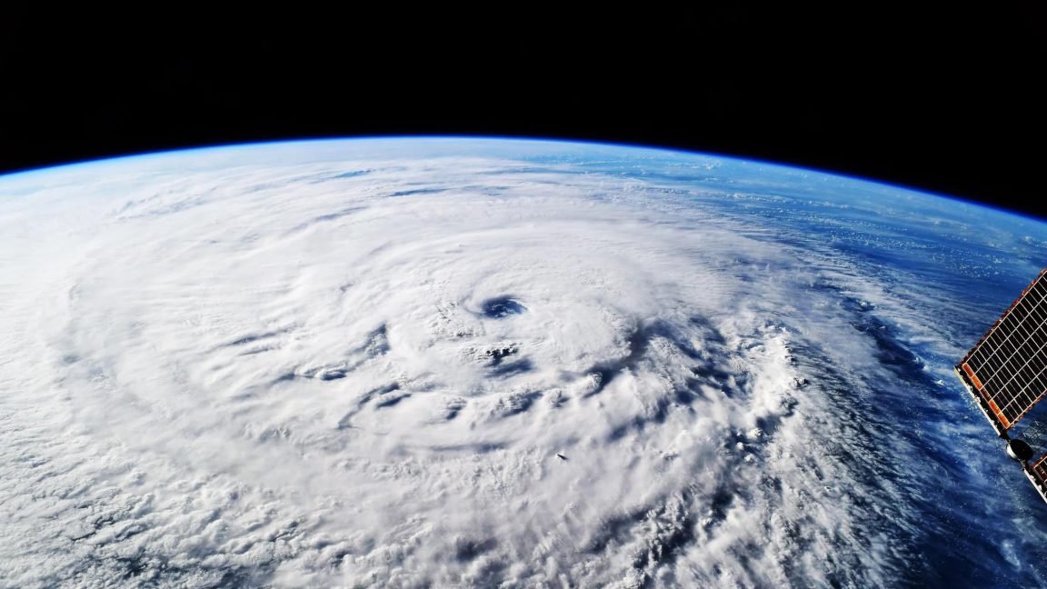
The reported performance is not framed only in statistical terms. The source text points to a real storm example from October 2025, when a system formed over the Caribbean and competing models differed over what would happen next. One possibility was that the storm would remain weaker and track toward Haiti. WeatherNext instead favored a more dangerous path and outcome. Five days before landfall, it assigned an 80 percent confidence that the storm would hit Jamaica as a Category 5 hurricane.
That storm, Hurricane Melissa, went on to be catastrophic, causing flooding and landslides across Jamaica. The article says the model helped forecasters provide earlier warning to communities in harm's way. That does not mean AI replaced human forecasting or removed uncertainty from the process. It means the model produced a signal early enough, and strong enough, to inform decision-making when every additional hour carried practical value.
That distinction matters in the broader AI debate. Many AI claims are presented as future-facing promises. This example is more concrete. It ties model performance to a specific operational context, a named storm, a confidence estimate, and a measurable forecasting advantage. The underlying message is less about spectacle and more about workflow: if a model can give meteorologists a better answer sooner, the result is not just a better chart, but a wider window for action.
What the paper says improved
The central claim from the paper is that WeatherNext predicts cyclones with unprecedented accuracy and, on average, provides a day more lead time than existing models. The source text expresses that in a practical benchmark: WeatherNext's predictions three days out were as accurate as previous models' predictions two days out. For forecasters, that kind of comparison is easier to interpret than a purely technical score because it translates directly into planning time.
Researchers quoted in the source also emphasize that such gains are difficult to achieve through conventional progress alone. Historically, bringing forecasts forward by a day could take a decade of work. That comparison helps explain why weather scientists were surprised by the result. It suggests the advance is not being treated as a marginal model refresh but as a potentially meaningful acceleration in forecasting capability.
The source text also notes an important constraint in applying machine learning to extreme weather. Hurricanes are rare relative to ordinary atmospheric conditions, and machine learning systems usually benefit from large amounts of training data. The researchers' answer, as summarized in the source material, was to train a model that is effective at weather overall while also learning cyclone behavior. In other words, instead of depending only on a limited set of storm examples, the model could draw from the much larger universe of weather data.
Why hurricanes are especially hard to model
Tropical cyclones are difficult forecasting targets because they operate across multiple scales at once. The source text says that predicting a storm's track requires information on a global scale. At the same time, forecasting the behavior of the storm itself involves smaller-scale dynamics. That multi-scale character is one reason hurricanes remain challenging even for advanced numerical weather systems.
WeatherNext's reported strength is therefore notable because it appears to manage that complexity while using lower-resolution weather data than some conventional methods. The supplied excerpt from Ars Technica describes this as one reason the model surprised weather scientists. If a model can extract more forecast value from lower-resolution inputs, it raises practical questions beyond pure accuracy. It could affect computational efficiency, accessibility, and how forecasting agencies combine AI systems with established physics-based tools.
None of that means older methods are suddenly obsolete. The source material does not claim that. What it does support is a narrower but significant conclusion: AI models are beginning to show operationally meaningful performance in one of the hardest areas of weather prediction. That is a stronger statement than saying AI is useful in principle. It suggests a path toward real integration into forecasting practice.

What an extra day means in practice
Lead time is not an abstract metric for emergency managers. The source text quotes Mike Brennan, director of the US National Hurricane Center, stressing that time is "golden" in these decisions. Even when the forecast is not perfect, earlier confidence can help officials prepare shelters, pre-position crews, warn vulnerable communities, and decide whether evacuation messaging should escalate.
That practical framing is one reason this result stands out. Many AI applications promise efficiency gains inside back-office systems. Cyclone forecasting is different because the public consequences are visible and immediate. Better predictions can shape whether roads jam, whether aid reaches the right areas, and whether communities receive enough notice to act. A one-day improvement does not eliminate the destruction a major storm can cause, but it can change the margin in which damage and loss unfold.
The publication of the work in Nature also signals that the result has moved beyond a company demonstration into a peer-reviewed scientific setting. That does not end debate over how the model should be tested, deployed, or combined with existing systems. It does, however, mark a threshold. AI weather forecasting is no longer only a research curiosity or a marketing claim. It is increasingly being evaluated as infrastructure.
The larger shift
The broader industry significance is that AI may now be contributing to one of science's most demanding real-world prediction problems without waiting for a full replacement of traditional meteorology. The stronger interpretation is not that a single model has solved hurricanes. The more credible interpretation, based on the supplied source text, is that hybrid forecasting is becoming harder to dismiss.
For governments and forecasting agencies, the key question is likely to become how quickly such systems can be validated, operationalized, and trusted within official warning pipelines. For the public, the takeaway is simpler. A better storm forecast delivered earlier can save time, and time is often the most limited resource before landfall. If WeatherNext consistently delivers the edge described in the paper, the impact of this advance will be measured less by AI headlines than by decisions made one day sooner.
This article is based on reporting by Ars Technica. Read the original article.

Originally published on arstechnica.com