The flood risk may matter more than the storm name
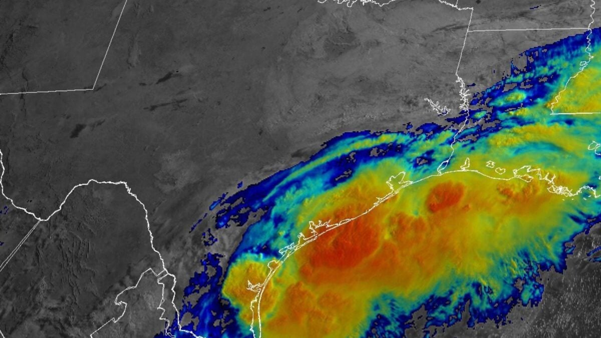
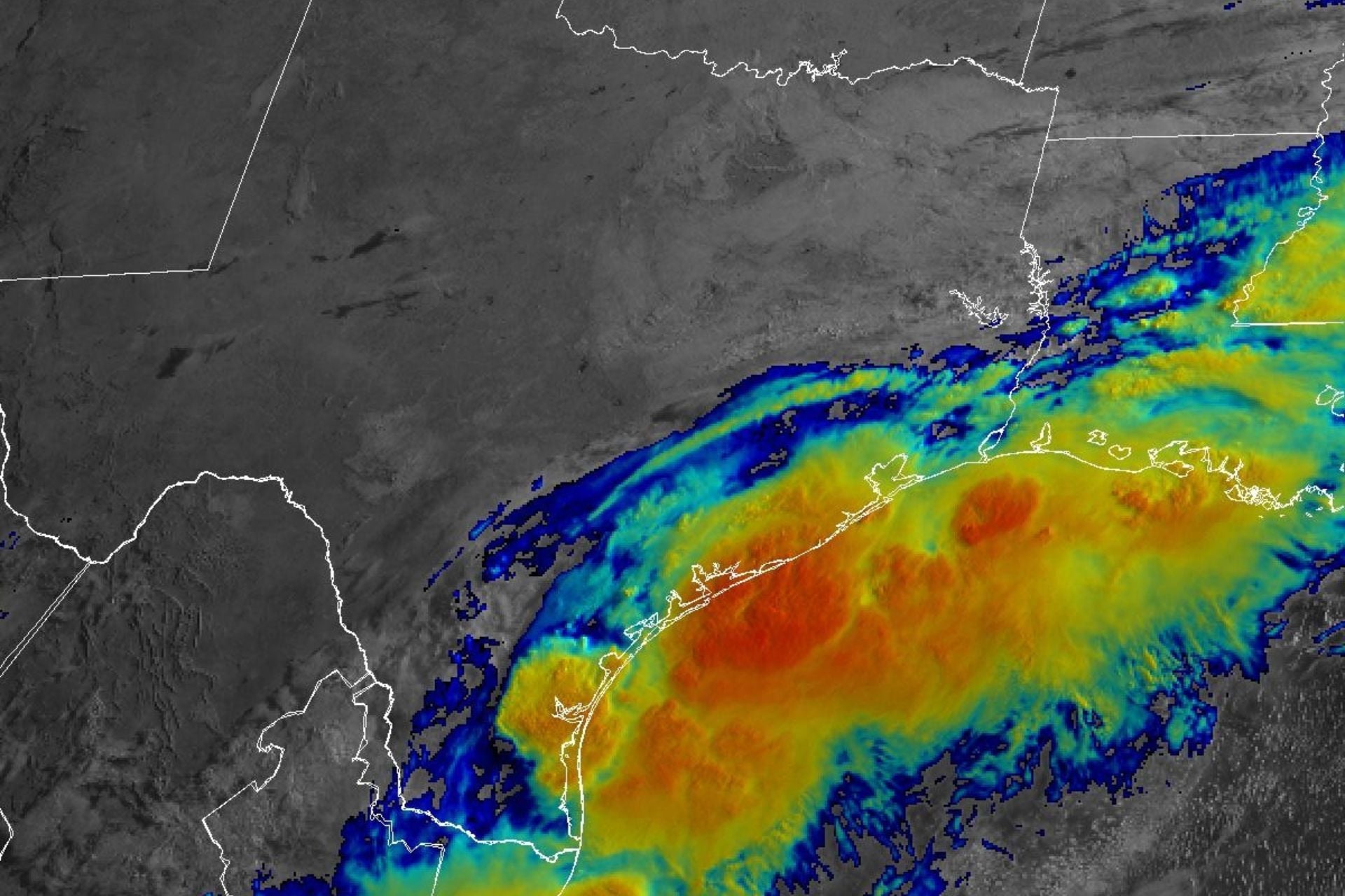
A developing system near South Texas could become the first tropical storm of the Atlantic hurricane season, but forecasters are warning that its most dangerous feature may be heavy rain rather than wind. As of the morning of June 16, the National Hurricane Center said the disturbance was producing a large area of disorganized showers and thunderstorms over South Texas and gave it a 60% chance of developing into a tropical cyclone within 48 hours.
If it strengthens enough to receive a name, the system would become Arthur. But federal forecasters have stressed that formal tropical cyclone status is not the key issue for communities in its path. The more urgent concern is the prospect of prolonged, intense rainfall across a wide corridor stretching from Texas toward the eastern Gulf states and potentially farther east.
A broad rain event is already taking shape
The National Hurricane Center warned that southern and eastern Texas, southern portions of Louisiana and Mississippi should prepare for periods of intense rainfall over the next several days. The agency said those downpours could produce widespread, life-threatening flash, urban and river flooding. That warning was reinforced by flood watches issued by the National Weather Service from South Texas across southeastern parts of the state, through much of Louisiana and into south-central Mississippi.
Forecast rainfall totals illustrate why officials are emphasizing flooding so heavily. Over a three-day period, forecasters expect storm-total amounts of five to seven inches in parts of the region, with locally higher totals along the Texas coastline into Louisiana. Some localized areas could receive more than a foot of rain by Friday.
Those are dangerous amounts even for places used to warm-season downpours. Flooding becomes more likely when repeated bands of rain move over the same areas, especially where urban pavement limits drainage or rivers are already elevated. The risk is not confined to one city or one short-lived burst. Cities named in the source reporting include Houston, Lafayette, Jackson, Montgomery and Atlanta, underscoring how widely the moisture plume could extend.

Why this system is dangerous even if it stays disorganized
One of the easiest mistakes during early-season Gulf weather is to focus too narrowly on whether a system becomes a named storm. In this case, the setup itself is capable of producing a serious flood event. The disturbance is moving slowly and carrying deep tropical moisture. At the same time, that moisture is expected to collide with a stalled cold front inland from the Gulf Coast. That combination can trigger excessive rainfall regardless of whether the disturbance organizes into a well-defined cyclone.
Meteorologists also pointed to exceptional atmospheric moisture. In some areas, precipitable water values near four inches were forecast, an unusually high signal that the atmosphere will be capable of unloading very heavy rain efficiently. When that much moisture is available, flooding can escalate quickly, especially if storms repeatedly train over the same communities.
An already active situation in Texas
The threat is not theoretical. Flooding had already begun in parts of Texas on Monday, including areas from Austin to the Rio Grande Valley and San Antonio, according to the source reporting. That means some places could enter the heaviest phase of this event with saturated ground or water already standing in vulnerable locations. When that happens, each additional round of rain has a greater chance of producing flash flooding and straining local response capacity.
The next several days will determine whether this system becomes a named tropical storm, but the more immediate public-safety issue is already clear. From South Texas into parts of the Deep South, the region is facing a rain-driven threat large enough that storm classification may end up being a secondary detail. For residents, the practical question is not what the system is called. It is how much water falls, how fast it falls, and whether communities move early enough to avoid the worst consequences.
This article is based on reporting by Gizmodo. Read the original article.

Originally published on gizmodo.com