అంతరిక్ష ప్రయాణంలో చాలా కాలంగా ఉన్న సమస్యను లక్ష్యంగా చేసుకున్న funding round
SpaceNews ఇచ్చిన నివేదిక ప్రకారం, GPS లేకుండా spacecraft navigation కోసం softwareను ముందుకు తీసుకెళ్లడానికి Rhea Space Activity Series A roundలో 6 మిలియన్ డాలర్లు సమీకరించింది. Washington, D.C.-ఆధారిత సంస్థ, satellite positioningపై ఆధారపడకుండా onboard optical sensorsను ఉపయోగించే AutoNav అనే visual-based navigation system అభివృద్ధిని ఈ funding వేగవంతం చేస్తుందని చెబుతోంది.
మొదటి చూపులో ఈ మొత్తం పెద్ద aerospace financing ప్రమాణాల ప్రకారం కొంచెం చిన్నదిగా అనిపించవచ్చు. కానీ లక్ష్యం వ్యూహాత్మకంగా చాలా ముఖ్యమైనది. GPS ఆధునిక navigationలో లోతుగా నాటుకుపోయినప్పటికీ, అది spaceflight ప్రతి దశలో ఎల్లప్పుడూ అందుబాటులో లేదా నమ్మకంగా ఉండదు. GPS signals అందని, బలహీనపడిన, లేదా అసలు వర్తించని పరిసరాలపై దృష్టి పెట్టడం ద్వారా, autonomy, resilience, మరియు mission flexibility సంగమంలో ఉన్న సమస్యను Rhea ఎదుర్కొంటోంది.
GPS-రహిత navigation ఎందుకు ముఖ్యమో
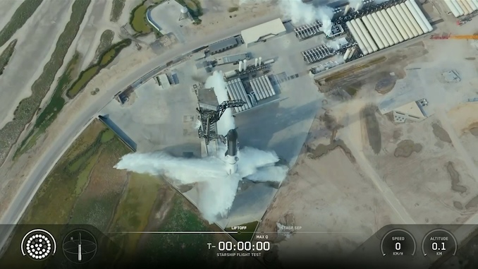
Rhea softwareను atmospheric reentry మరియు deep space వంటి పరిస్థితుల్లో ఉపయోగించేందుకు ఉద్దేశించిందని report చెబుతోంది. ఈ రెండు ఉదాహరణలు ప్రభుత్వం మరియు వాణిజ్య operator-లకు alternative navigation tools ఎందుకు మరింత ఆకర్షణీయంగా మారాయో వివరిస్తాయి. Spacecraft ప్రతి mission profileలోనూ satellite-based positioningకు uninterrupted access ఉందని ఊహించలేవు. communications పరిమితం అయినప్పుడు లేదా signals అంతరాయానికి గురైనప్పుడు, onboardగా position మరియు trajectoryను నిర్ణయించగల సామర్థ్యం ఎంతో విలువైనదిగా మారుతుంది.
AutoNav కోసం Rhea చేస్తోంది అదే వాదన. external positioning infrastructureపై ఆధారపడకుండా, ఈ system satellites, moons, planets, asteroids, comets వంటి moving space objects చిత్రాలను ఉపయోగించి, ఆ imagesను known positionsతో పోల్చి movement మరియు locationను లెక్కిస్తుంది. ప్రాక్టికల్గా, ఇది spacecraft autonomyను పెంచే ప్రయత్నం: conventional support అందుబాటులో లేకపోయినా లేదా అవసరం లేకపోయినా navigation కొనసాగించగల మార్గం.
దీని విస్తృత ఆకర్షణ సాంకేతిక సొగసును మించి ఉంటుంది. Space operators బలహీనమైన లేదా పోటీ ఉన్న external servicesపై ఆధారాన్ని తగ్గించే systemsను ఎక్కువగా కోరుతున్నారు. GPS లేకుండా పనిచేసే navigation approach ఆ pushకు సరిపోతుంది, ముఖ్యంగా delay, signal పరిమితులు, లేదా operational risk స్వతంత్రతను మరింత ముఖ్యంగా చేస్తున్న పరిసరాలకు పని తరలుతున్నప్పుడు.
NASA heritage technologyకు బలమైన ప్రారంభాన్ని ఇస్తుంది
ఇచ్చిన reportలో అత్యంత ముఖ్యమైన వివరాల్లో ఒకటి system యొక్క మూలం. AutoNav మొదట NASA Jet Propulsion Laboratoryలో అభివృద్ధి చేయబడింది, అక్కడ Earth నుంచి నిరంతర guidance లేకుండా spacecraft position మరియు trajectoryను తెలుసుకునేలా చేయడమే లక్ష్యంగా పెట్టుకున్నారు. ఇది కేవలం brand-name endorsement కాదు. autonomy అనేది సౌకర్యం కాదు, అవసరం అయిన mission context నుండి ఈ idea వచ్చిందని ఇది సూచిస్తుంది.
JPL roots ఉన్న technology space sectorలో భిన్నమైన స్థాయి credibilityను కలిగి ఉంటుంది, ముఖ్యంగా commercial కథ operational independenceపై ఆధారపడినప్పుడు. ఇది market successను హామీ ఇవ్వదు, కానీ కంపెనీ కేవలం ఊహాజనిత conceptను ప్రదర్శించడం లేదని అర్థం. AutoNavను high-consequence spaceflight అవసరాలతో ఇప్పటికే అనుసంధానమైన navigation approachను commercialize చేసి మరింత అభివృద్ధి చేసే ప్రయత్నంగా report చూపుతోంది.
ఆ heritage visual-navigation modelను కూడా వివరించడానికి సహాయపడుతుంది. Spacecraft చుట్టూ reference points ఉంటాయి. అసలు సమస్య observable objects లేకపోవడం కాదు, ఆ observationsను reliable, onboard calculationsగా మార్చడం. reportలో చెప్పిన AutoNav పద్ధతి ఆ premiseపై ఆధారపడి ఉంది.
ఒక test flight కంపెనీకి సమీప కాలపు milestoneను ఇస్తుంది
Varda Space Industries అభివృద్ధి చేసిన reentry capsuleపై systemను test చేస్తామని Rhea చెబుతోంది; అది మార్చి 30న orbitకు launch అయింది. ఇది ముఖ్యమైన విషయం, ఎందుకంటే ఇది కథను concept development నుంచి operational validation దిశగా తీసుకెళ్తుంది. Space technology investors ఎక్కువగా software లేదా hardware నిజమైన mission conditionsలో నిలబడగలదనే ఆధారాన్ని చూస్తున్నారు.
Reentry అనేది ప్రత్యేకంగా ఆసక్తికరమైన test environment. ఇచ్చిన report ప్రత్యేకంగా atmospheric reentryను GPS అందని పరిస్థితుల్లో ఒకటిగా పేర్కొంటుంది. AutoNav ఆ settingలో ఉపయోగకరమైన navigation performance ఇవ్వగలిగితే, ఈ system దూరమైన deep-space missionsకే కాదు, దగ్గరి కాలంలోని commercial operationsకూ సరిపోతుందనే వాదన బలపడుతుంది.
దీని ప్రాముఖ్యత ఏమిటంటే GPS-independent navigation market బహుశా layer-by-layerగా ఏర్పడుతుంది. Deep-space capability ప్రతిష్ఠను మరియు దీర్ఘకాల ప్రాముఖ్యతను ఇస్తుంది, కానీ ఎక్కువగా జరిగే commercial missions ముందస్తు proof points మరియు revenue అవకాశాలను అందించగలవు. Reentry capsuleపై విజయవంతమైన test, అదే core approach space economy యొక్క అనేక భాగాలకు ఉపయోగపడగలదనే భావనకు మద్దతిస్తుంది.

ఈ timing resilient space systems వైపు ఉన్న విస్తృత మార్పుతో సరిపోతుంది
GPSకు alternatives ప్రభుత్వ మరియు వాణిజ్య operator-లు అంతరాయం కలిగించగలిగే లేదా degraded అయ్యే navigation systemsపై ఆధారాన్ని తగ్గించాలని కోరుకోవడంతో దృష్టి పొందాయని report చెబుతోంది. ఆ విస్తృత trend వల్లే ఈ financing story ముఖ్యమైంది. ఇది కేవలం ఒక startup ఒక round సమీకరించిందనే విషయం కాదు. ఇది ఒత్తిడిలో కూడా పనిచేయగల space infrastructure నిర్మించే పెద్ద ప్రయత్నంలో భాగం.
Resilience civil మరియు military space రెండింటిలోనూ ఒక నిర్వచనాత్మక పదంగా మారింది. Operators మరింత onboardగా చేయగల, నిరంతర బయటి మార్గదర్శకతపై తక్కువగా ఆధారపడే, links పరిమితమైనప్పటికీ పనిచేయగల spacecraftలను కోరుతున్నారు. Optical navigation ఆ agendaకు బాగా సరిపోతుంది. ఇది contested, communication-limited, లేదా పూర్తిగా దూరమైన environmentsలో మరింత self-sufficientగా ఉండే vehiclesకు మార్గం చూపుతుంది.
Investorsకు ఆకర్షణ సూటిగా ఉంటుంది. GPS లేకుండా navigation భవిష్యత్ spacecraft classesకు core requirement అయితే, ఆ సమస్యలో భాగాలను పరిష్కరించే కంపెనీలు ముఖ్యమైన suppliersగా మారవచ్చు. Rhea యొక్క Series A ఆ thesisకు technologyని మరింత scale చేయడానికి తగిన నమ్మకం ఉందని సూచిస్తోంది.
ఈ funding round నిజంగా ఏమి సూచిస్తోంది
అత్యంత బలమైన takeaway డాలర్ మొత్తం మాత్రమే కాదు. Autonomous navigation ఒక ప్రత్యేక engineering concern నుంచి స్పష్టమైన commercial category వైపు కదులుతోంది అన్నదే. Conventional positioning tools తక్కువగా ఉన్నప్పుడు, తదుపరి తరం spacecraftలకు తాము ఎక్కడున్నాయో, ఎక్కడికి వెళ్తున్నాయో తెలుసుకునే మరింత intelligence అవసరం అవుతుందని Rhea పందెం వేస్తోంది.
ఇది ఇచ్చిన report ఆధారంగా విశ్వసనీయమైన దిశ. కంపెనీకి బయట నుంచి capital ఉంది, NASA-నుంచి వచ్చిన technology base ఉంది, మరియు నిజమైన flightకు అనుసంధానమైన test opportunity ఉంది. Space technologyలో, ఇలాంటి కలయిక ఆసక్తికరమైన conceptను ట్రాక్ చేయదగిన కంపెనీగా మార్చడంలో తరచుగా కీలకమవుతుంది.
ఈ round ఎందుకు ముఖ్యమో
- Rhea Space Activity GPS-రహిత spacecraft navigation softwareను ముందుకు తీసుకెళ్లడానికి Series A roundలో 6 మిలియన్ డాలర్లు సమీకరించింది.
- కంపెనీ AutoNav system satellite-based positioningకు బదులుగా onboard optical sensors మరియు space objects చిత్రాలను ఉపయోగిస్తుంది.
- ఈ technology NASA JPL నుండి వచ్చినది మరియు deep space, atmospheric reentry వంటి use casesను లక్ష్యంగా పెట్టుకుంది.
- Varda reentry capsuleపై planned test, కంపెనీకి సమీప కాలంలో validation milestoneను ఇస్తుంది.
ఈ వ్యాసం SpaceNews నివేదిక ఆధారంగా ఉంది. మూల వ్యాసాన్ని చదవండి.
Originally published on spacenews.com