CultureMore in Culture→
NASA’s New Radar View Shows Mexico City’s Uneven Descent in Stark Detail
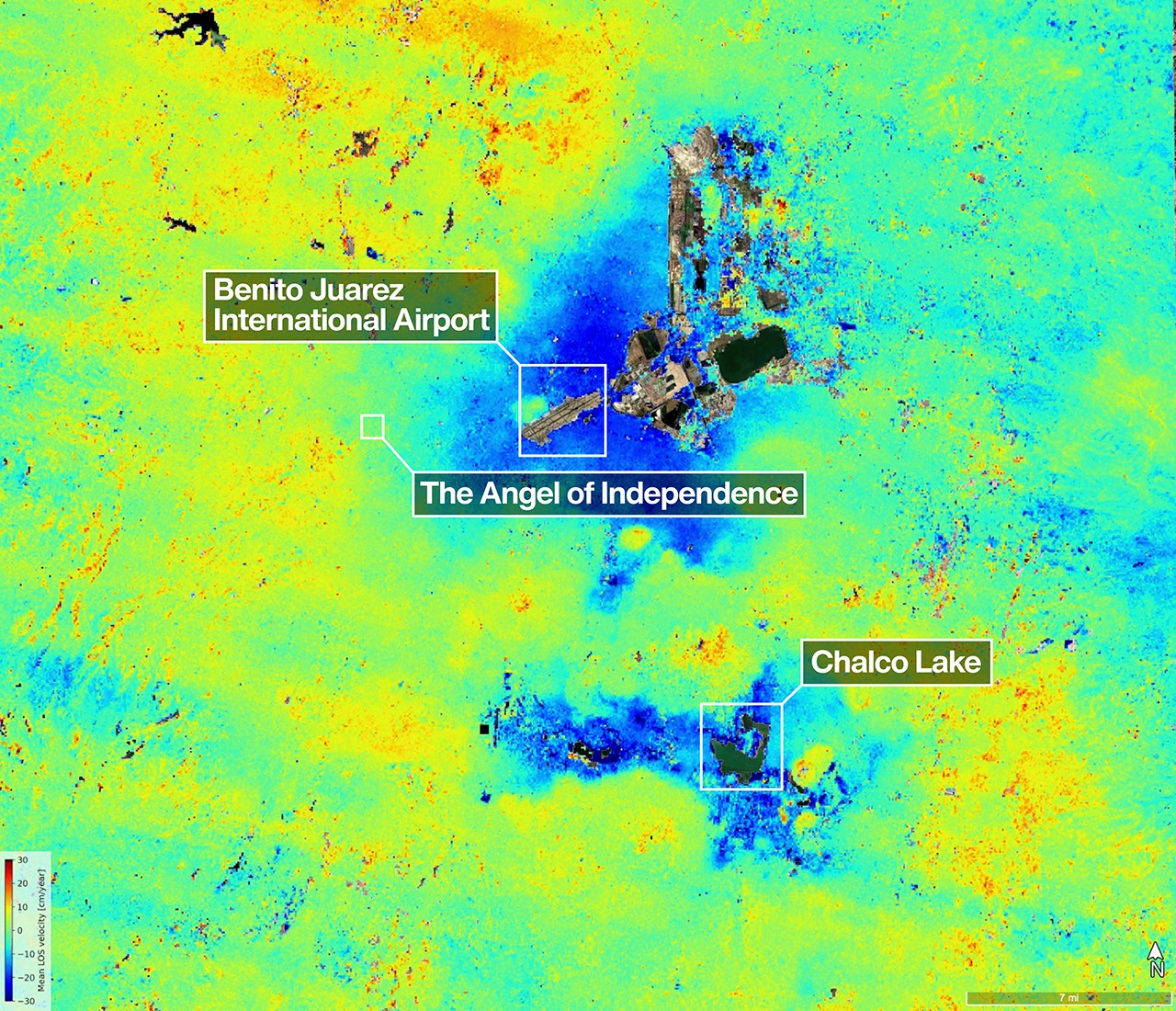
Key Takeaways
- NISAR data show some areas of Mexico City sinking by more than 2 centimeters per month.
- NASA links the subsidence to groundwater pumping and the compaction of ancient lake-bed soils.
- The uneven nature of the sinking makes infrastructure damage more likely and harder to manage.
DE
DT Editorial Team··via wired.com