SpaceMore in Space→
Landsat Captures the Scar of a Powerful Mississippi Tornado
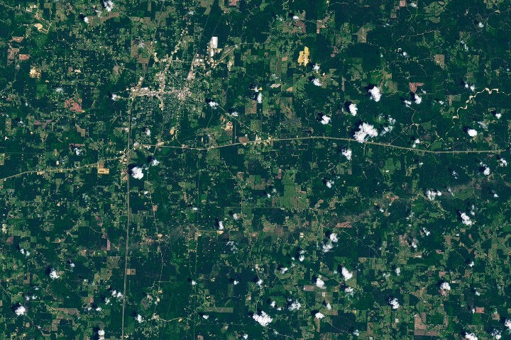
A Landsat 8 image shows a brown track cut through southern Mississippi after an EF-3 tornado traveled nearly 82 miles, offering a stark satellite view of storm damage on the ground.
Key Takeaways
- Landsat 8 captured visible vegetation damage from a May 6 tornado in Mississippi.
- The EF-3 storm traveled nearly 82 miles across five counties.
DE
DT Editorial Team··via science.nasa.gov