A damaging inland quake hit Kyushu and raised technical questions
A strong earthquake struck southwestern Japan near Kumamoto on July 28, damaging buildings, trapping people inside a partially collapsed shopping center, and forcing large-scale evacuations. Beyond the immediate destruction, the event drew attention for another reason: different agencies reported different magnitudes for the same quake, underlining how earthquake measurement depends on what exactly is being measured.
The supplied source text says the U.S. Geological Survey measured the quake at magnitude 6.8. Japan’s Meteorological Agency, by contrast, reported it as magnitude 7.1. That difference does not mean one agency necessarily got the event wrong. It reflects the use of different magnitude types, each designed to capture different aspects of the rupture and the shaking it produced.
What happened in Kyushu
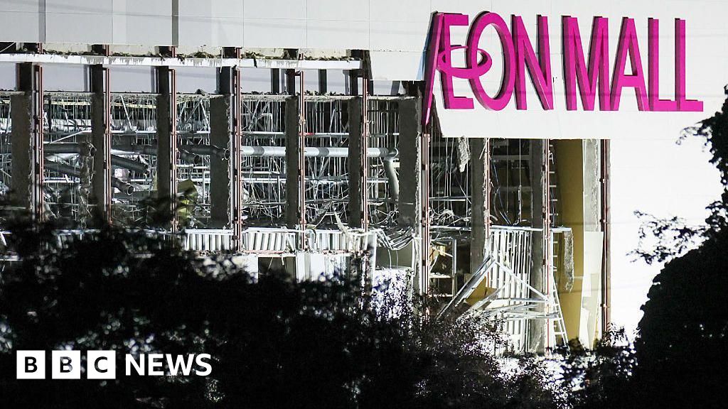
According to the source text, the earthquake struck at 4:27 p.m. local time near Kumamoto, a city of more than 700,000 people on Japan’s Kyushu island. The shaking damaged infrastructure across the region. Roads buckled, thousands of homes lost power, and part of a shopping mall collapsed, trapping shoppers inside. Some of those people were evacuated and later hospitalized.
The quake also damaged a stone wall at Kumamoto Castle, one of the area’s best-known historic landmarks. More than 150,000 people were sent to evacuation shelters, according to the report cited in the source text. Authorities briefly issued a tsunami warning, then lifted it within an hour.
Even without a long-lived tsunami threat, the event was severe enough to disrupt ordinary life across a broad area. Power loss, structural damage, and evacuations point to a quake with consequences well beyond the immediate epicentral zone.

Why the earthquake was described as unusual
The source material characterizes the event as a strong inland earthquake in southwestern Japan. Inland earthquakes can be especially destructive because they occur closer to populated areas and can produce intense local shaking. In this case, the damage to buildings, collapse within a shopping center, and strain on transportation and power systems all reflect that near-field impact.
The report also emphasizes the scientific side of what made the earthquake notable: the discrepancy between the U.S. and Japanese magnitude readings. For the public, two different headline numbers can create confusion. For seismologists, though, the difference is a prompt to explain how earthquake size is estimated and why multiple scales remain in use.
Why one agency said 6.8 and another said 7.1
The source text says the U.S. Geological Survey’s 6.8 estimate and the Japan Meteorological Agency’s 7.1 estimate differ primarily because the agencies used different magnitude types. Japan reported a local magnitude, while the USGS reported a moment magnitude.
Those are not interchangeable labels. Local magnitude is tied more directly to how strongly the ground shakes near the event, while moment magnitude is based on the physical size of the rupture and the total energy released along the fault. The source text notes that the USGS describes moment magnitude as the most reliable estimate of earthquake size for large earthquakes because local magnitude scales can lose accuracy as ruptures grow larger.
In simple terms, local magnitude is useful for describing the quake’s immediate shaking characteristics, while moment magnitude is better suited to comparing the total scale of large events across different regions and fault systems. Both numbers describe the same earthquake from different analytical angles.
Why that distinction matters
Magnitude is not just a technical footnote. It shapes public understanding, media coverage, and in some cases the expectations people form about aftershocks and damage. When two authorities report different values, it can look like uncertainty about the event itself. More often, it reflects confidence in different methods built for different purposes.
The source text explains that different magnitude types capture different characteristics of earthquake source processes. That is the key point. Earthquakes are not single-number phenomena in the way a speed limit or a temperature reading is. Scientists use several tools to describe them because no single metric fully captures every dimension of a rupture.
That distinction is especially important in tectonically active countries such as Japan, where dense monitoring networks and long experience with seismic hazards produce highly detailed domestic reporting alongside international assessments.
Why aftershocks still matter
The source text warns that aftershocks remain a concern. That is a practical as well as scientific issue. After a major quake, already weakened buildings, walls, roads, and utility systems can fail further under smaller subsequent tremors. Evacuation centers and emergency services must therefore plan not only for the main shock’s impact but also for a prolonged period of instability.
Inland events can be particularly stressful in that regard because they affect dense human environments directly. A partially collapsed mall, damaged heritage structures, and buckled roads all create conditions where secondary shaking may deepen the damage or complicate rescue and recovery work.

What this event shows about earthquake risk
The Kyushu earthquake is a reminder that earthquake risk is not only about maximum possible magnitude. It is also about where a rupture occurs, how close it is to cities and infrastructure, how buildings perform, and how quickly officials can move people out of harm’s way. In this case, the source text points to broad disruption: hospitalizations, mass sheltering, power loss, damaged roads, and concern over tsunami and aftershock hazards.
It also shows the value of fast scientific interpretation. The difference between a 6.8 and a 7.1 headline could easily become a distraction. Properly explained, it becomes a useful lesson in how modern seismology works and why multiple agencies may describe the same earthquake differently without contradicting each other.
The larger takeaway
Japan’s July 28 earthquake near Kumamoto was destructive because of where it struck and how strongly it affected communities in southwestern Japan. It was also educational because it highlighted the mechanics of earthquake reporting itself. The event combined immediate human consequences with a public-facing lesson in seismic measurement, showing that the story of an earthquake is never contained in a single number.
For residents and emergency responders, the priority remains safety, shelter, and monitoring for further shaking. For everyone else following the event, the most useful takeaway may be this: differences in reported magnitude do not necessarily signal confusion. They can instead reveal the complexity of the earth processes scientists are trying to measure in real time.
This article is based on reporting by Live Science. Read the original article.
Originally published on livescience.com