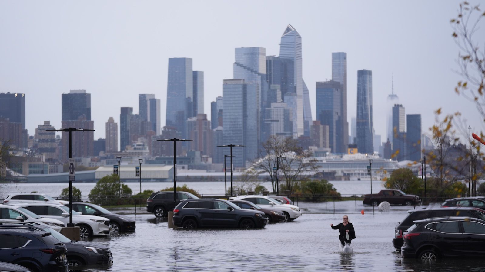
New York stands out in a sharper flood-risk picture
A new flood risk index has identified eight U.S. East Coast cities as facing high or very high risk of extreme flood damage under current scenarios, with New York City standing out as the most exposed in absolute terms. According to the report highlighted by Live Science, New York had the largest number of people and buildings at high risk of extreme flood damage among East Coast cities included in the analysis.
The headline figure is stark: 4.4 million people in New York City could be exposed to extreme damage. That does not mean every one of those residents will experience the same outcome or on the same timetable. It does mean the city sits at the center of a major concentration of physical and human vulnerability when flood exposure is measured at scale.
The same report says New Orleans also ranks among the most threatened locations, underscoring that the issue is not confined to a single metropolitan area. But New York’s position matters because of its density, the sheer value of its built environment, and its national importance as a financial, transport, and housing center. When the most populous city in the United States emerges as the largest absolute exposure case in a coastal flood index, the result carries significance well beyond local planning debates.
Why this index matters
Flooding is not a new topic for East Coast cities, but index-based assessments can change how the threat is understood. Rather than focusing only on hazard maps or individual storm histories, an index can combine exposure measures in a way that reveals where extreme damage potential is clustering most heavily. In this case, the source text emphasizes two key dimensions: people and buildings.
That dual framing is important. A city can have serious flood hazards but limited absolute exposure if fewer people or structures are located in the most vulnerable zones. New York is the opposite case. Its exposure is amplified by concentration. Large populations, dense development, and infrastructure-heavy urban form mean that flood damage can cascade through housing, transit, utilities, commerce, and emergency response simultaneously.
The analysis also points to a broader regional pattern. Eight East Coast cities were classified as high or very high risk. That suggests the problem is systemic rather than exceptional. Coastal flood vulnerability is not just about one famously storm-prone place. It reflects a corridor-wide challenge in which multiple urban centers face the prospect of severe disruption.

From abstract climate risk to urban damage potential
One reason studies like this gain attention is that they translate climate and coastal risk into more direct questions about damage. Extreme flood damage is not only about water depth. It is about what is in the water’s path and how much of a city’s population and built environment can be caught inside that zone.
For New York, that changes the tone of the discussion. The city has spent years expanding resilience planning, hardening infrastructure, and reassessing waterfront development after prior storm shocks. Yet the new index suggests that even under current scenarios, the scale of exposure remains immense. In other words, adaptation efforts may be necessary but not sufficient if the baseline level of urban exposure is this high.
The finding also sharpens the policy challenge. Protecting millions of people and a vast building stock is fundamentally different from defending a smaller, less dense coastal settlement. Measures that work in isolated districts may not scale cleanly across an entire metropolitan region. New York’s flood problem is therefore not just a matter of engineering barriers or improving drainage. It is also a problem of prioritization, land use, infrastructure interdependence, and long-term investment capacity.
What the East Coast pattern suggests
The inclusion of eight high-risk or very high-risk East Coast cities points to a wider shift in how coastal urban vulnerability is being discussed. Rather than treating flood exposure as a series of disconnected municipal issues, the index frames it as a regional pattern with shared structural drivers. Cities on the Atlantic seaboard often combine aging infrastructure, concentrated assets, and extensive coastal interfaces. That means damage can spread quickly when defenses are exceeded.
New Orleans’ appearance near the top of the rankings reinforces that point from a different urban context. It is not interchangeable with New York in scale or geography, but it is part of the same broader story: some U.S. cities face flood exposure levels that are best understood as extreme-risk management problems rather than routine resilience challenges.
That framing may affect where money and political attention flow next. Risk rankings often shape public debate because they offer a way to compare cities directly. Once a city is identified as having the largest absolute exposure, the burden of proof changes. The issue is no longer whether flood risk deserves attention. The question becomes whether current planning matches the documented scale of the threat.

A warning with national implications
The new index does more than flag local danger. It highlights how much national exposure is embedded in a handful of coastal metros. In New York, the concentration of people and buildings means flood risk is inseparable from questions about housing stability, economic continuity, public services, and emergency preparedness. Damage at that scale would not stay local for long.
That is why the report’s finding deserves attention beyond climate specialists and city agencies. A city with 4.4 million people exposed to extreme flood damage is not confronting a marginal hazard. It is confronting a major urban risk that intersects with infrastructure, insurance, development, and public safety all at once. If the index is right, New York is not simply one vulnerable city among many. It is the clearest case study in how concentrated coastal exposure can turn flooding into a metropolitan-scale systems problem.
This article is based on reporting by Live Science. Read the original article.
Originally published on livescience.com


